Earth Hour looked pretty cool in Toronto. This was....last weekend? I walked down to the water to check it out (also that way all my lights were off. just a symbolic gesture, I realize). CN Tower looked striking. Maybe a few of the tall buildings will take the message to heart and turn off more lights at night. I tried to take a picture, but it was pretty terrible. Not-worth-posting-terrible. If you'd like an idea of what it looked like, go into a dark room and a take a picture with no flash.
If you want to be inspired with photography, check out some of the shots from my friend Heath. Good work five-sevenths!
Totally unrelated, this nice weather has got me wonder if there is a way that I might get back on the West Coast Trail this summer. I really want to go back. It rained - should-we-consider-gathering-two-of-every-animal sort of rain - the first time I did the WCT , and I still had an absolute blast. This time, I want to go south to north, but that's about as far as my planning has taken me.
Time to get out for a ride.
Showing posts with label West Coast Trail. Show all posts
Showing posts with label West Coast Trail. Show all posts
Thursday, April 1, 2010

Thursday, September 11, 2008
West Coast Trail - Thrasher Cove to Gordon River (km 75)

 The last few kms were pretty tough and technical. We were pretty motivated: showers! sushi in Victoria! We were hiking pretty fast, but I think it still took us until about 1 o'clock to get to the end (km 75!).
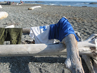
Just before the end, we started running into groups of people who were just starting their hike. For the most part, they looked pretty pie-eyed, and at km 74 to their 1, we felt like seasoned veterans. All the beginning hikers looked very very clean, and they smelled amazing. Everyone. Even normally very unattractive people. At this point we smelled horrendous, I'm sure! My Prime jersey especially had several suggestions of incineration rather than cleaning.

The second ferry of the trail took us across the Gordon River and back to the WCT trailhead to check out. When we checked in to start the hike, there was a whiteboard that said the number of folks evacuated from the trail since 2002, in the ballpark of 50-70 people a year. When we left, 41 (or 47, we couldn't tell) people had been evacuated. 5 days later when we finished our hike, 61 people had been evacuated!
There are hot showers in Port Renfrew that we a) heaven b) wonderful anti-hypothermia devices after waiting around for the boat, the permit, the lift back to the other side of Port Renfrew etc. I got 6 minutes of bliss for two loonies. I have no idea why they don't change $20 - I would have paid.

After the two hour drive between Port Renfrew and Victoria, we had a sushi feast and hopped the ferry to the mainland. We stayed overnight at Liesl's family friend's before making a break for home the next morning.
What an amazing trip! If you at all thinking of going (or maybe now you are) you should!
The photos in this post are somewhat random. More photo credits to Alli, and also some dude who conveniently ended the trail (don't miss the km 75 in the group shot) at the same time as us. A
 lli, Weaze, do either of you have a shot of the suspension bridge from day 4?
Wednesday, September 10, 2008
West Coast Trail - Cullite Cove to Thrasher Cove (km 70)
 The tides were such that the hiking this day was entirely in the forest. Two words: muddy roots. The kilometers between Camper Creek (km 62) and Thrasher Cove (km 70) were some of the toughest that we did. Each km took us about an hour! There was a cable car at Camper (I'll try to post a picture, maybe Weaze has one), and then muddy roots, muddy roots, and muddy roots.
Thrasher Cove took about an hour to hike down too, once we got to km 70. Thrasher was nice, but we knew it meant hiking the same km back up. We were pretty happy for this to be our last night, because at this point it had been raining long enough that pretty much all of our stuff was wet.

We unrolled our damp thermarests into the bottom of the tent (with it's mini-lake), and then sleeping bags after that. Mine was reasonably dry, just wet a bit on the outside, but surprisingly warm inside. That said, when we packed up the next morning (still raining, of course), we were pretty stoked to know if was the last pack up, and that we only had 5 km to go! 
Monday, September 8, 2008
West Coast Trail - Carmanah Point to Cullite Cove (km 58)
 I didn't take a lot of pictures on Day 4. It was still raining pretty hard when we packed up, and I decided to try and keep
 the camera dry for the day. I might have been influenced by the cable car that we got to start the morning with. It was a memorable cable car for me, because somehow I managed to lose one of my trekking poles. I clipped them too my backpack, and when I got to the other side, there was only one. I didn't think that it fell in the river, but I wasn't willing to go back to the other side to look for it, then back again. Cable cars are really tiring! It's a major upper body workout.

I don't remember too much about the hiking that day, just that it was fun, technical and that there was lots of water on the trail. I believe this was the day where two muskrats (or otters?) swam by in front of me on the trail. That's how much water was on the trail. Also, at one point I did the lumberjack log dance. I was stepping on logs to get across a small lake (aka the trail), and it turned out that all of them were floating and therefore rolling. I managed to make it across without bailing! I think this day may have been my first bail. I seemed to like falling on my ass on slippery boardwalks. No matter which way I slipped, I always seemed to land on my ass - I good thing, I realize, but I was starting to get a bit of a complex.
There were some major, major ladders to get down too, and back out of Cullite Cove. The book said there were 30 story's of ladders. I work on the 30th story of my building, and I think that's about right. 

The photos I posted in this one are view from the toilet (I actually think this is Michigan Creek, but what the heck, I didn't take a lot of pictures on day 4), a random boardwalk, random ladder and camp at Cullite, and cooking dinner. The last one with the sleeping bags is another photo credit for Alli. This photo kills me! Weaze and I bought the same sleeping bag (it's great!), and that night was cold. I think my nose was the only thing showing!


Saturday, September 6, 2008
West Coast Trail - Tsusiat Falls to Carmanah Point (km 46)
 Day 3 was our 'big day' of hiking - 20 kms. Right off the bat, we got to go through the Hole in Wall (km 27), which I had been looking forward too for a while. You have to time the tides right to walk through the Hole in the Wall (otherwise you have to walk around it via the forest route).
The first Ferry crossing was this day, at Nitinat Narrows (km 32). This was part of the reason we stayed at Tsusiat Falls (we got there early, 3 pm) - the Ferry only runs between 10 am and 4 pm, or so. We needed to get there during the day. The Ferry crossing was kind of cool, Weaze bought us Cokes on the other side (what a treat!) and
 I spent more of the rest of the day saying 'Nitinat Narrows' over and over in my head - funsies.
We drank the Cokes a while past the Narrows with lunch - Spam lunch. Sound gross? Normally I would agree. It was SO good. Mmmm, Spam. Don't worry, it was the reduced salt kind.
Km 34 was the area called Clo-oose that made Weaze and I laugh during the orientation. Are we there yet? No, but we're Clo-oose.
We pushed on, and up (SO up) to the lighthouse at Carmanah Point (km 44). This was a major lung and leg burner. Thankfully there was a great view of sealions from the top for distraction.

Km 45 was Chez Moniques - now it will all make sense why we hiked so far in one day. Chez Moniques is a little resteraunt on the beach that serves burgers and beer! Yum. Okay, so I had my second Coke of the day instead of a beer. The burgers were huge and decilious. There was a tarp covering the tables, which was good, becuase it started raining (read: pouring) while we ate dinner. We had pecan pie for dessert, trying to wait out the rain before going the last km (only 15 minutes) to the campsite at Carmanah Point. The rain out-waited us!
There were a couple of other hikers at Chez Moniques, but they must have camped there (or something), becuase we had Carmanah Point to ourselves. Well, not entirely to ourselves: there was a very young black bear hanging around too! Between the bear and the rain, it was a pretty early one in the tent.

 Note: photo credit to Alli on the Hole in the Wall shot, as well as the one with Weaze and I walking away.

West Coast Trail - Michigan Creek to Tsusiat Falls (km 26)
 On day 2, we hiking to Tsusiat Falls, at km 26. The day was a nice mix of beach and forest hiking, and we got to do our first cable car at km 23 (over the Klanawa River).
Tsusiat Falls was my favorite campsite because it was so beautiful. Check out the ladders down. It was a long way! The weather was nice, and we could swim in the falls. There were ledges behind the falls, so you could go behind and sit on them. It was lots of fun and good to get 'clean' (as if) after two days of hiking. Logistically, the campsite left something to be desired. It was a long way to get water, and even further to the bear locker and toilet. It wasn't that far, but keep in mind we had been hiking all day already. The extra hiking was worth it to be able to swim and even throw the frisbee (aka my dinner plate) on the beach. 


The West Coast Trail - Day One - North Trailhead to Michigan Creek (km 12)
 Hiking the West Coast Trail has been on my 'big' list of things to do for some time. I'd say 5-6 years in the 'one day I want to do that' category, and before that, some time in the 'that sounds cool' column. Check check!
Of course, it's not just about having done it. It's the experience itself, and that it was. I loved it - what an amazing place.
Planning the trip could some coordination and effort. You have to book permits (and therefore commit to timing) about three months in advance - that was probably the biggest thing. With permits in hand and the time booked off work, it was just a matter of planning and assembling the gear. I picked away it over the course of the summer (thanks for the loaner gear, and special thanks to Sue for all of the advice). The summer flew by and the trip snuck up. I didn't think about it for one minute during Nationals, at once that was over....wow, four days is not a lot of time.
 We left on Friday morning and stayed overnight with my aunt and uncle in Abbotsford. We took the Ferry to the island the next morning, and drove to Port Renfrew (about 2 hours on very windy roads) north of Victoria in time for the WCT orientation. Our permit allowed us to start hiking the Sunday, so we wanted to get the orientation finished the day before. That way we could start the trail earlier in the day on Sunday, when the WCT bus dropped us at the North trailhead about noon. The bus was an experience itself (it reminded me of riding buses in Cambodia). When we woke up in Port Renfrew that morning (we managed to get a hotel to stay in, over camping, through poor planning but good fortune) to the pouring pouring pouring, wow pouring rain.
 It stopped raining by the time we started the hike - a small miracle! In case you don't know them, my two friends are Liesl (aka Weaze, in green) and Alli (in tan).
When starting the hiking in this direction (making us either "Northies" or "Southies", I can't remember if its the where you start or where you are going.......), you don't have a choice of first campsite. The first one, Michigan Creek at km 12 is the only option. The hike starts off reasonably gradually, considering the whole trail. That said, there are ladders at about km 2! We sure knew we had started. 
There pics are all from the first day, including the Panchena Lighthouse (km 10), and the Michigan Creek Campsite (km 12).

Subscribe to:
Posts (Atom)